See your maps at gigantic scale with the Altus Mapping Engine
Friday, June 5th, 2015 at 5:13 pm by ba3 — Category: News
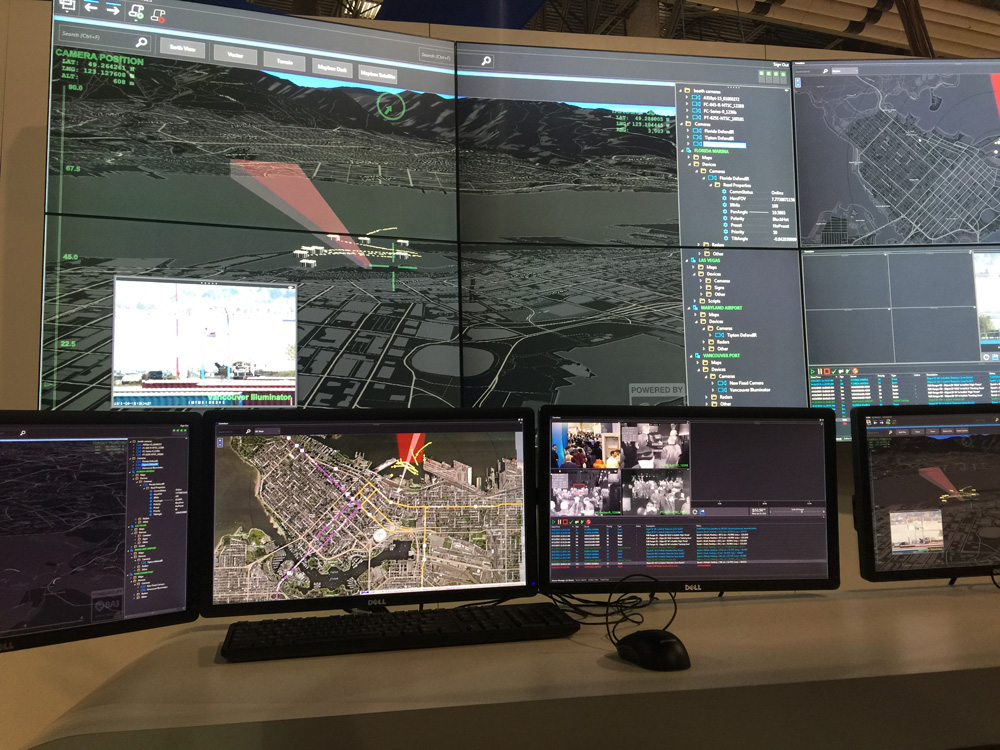
At ISC WEST in Las Vegas, NV, the largest security industry trade show in the U.S., FLIR demonstrated their new Chameleon surveillance system with BA3′s Altus Mapping Engine integrated. This was the first public demonstration of the Altus .NET-based WPF control integrated into a Windows desktop-based enterprise solution. Enabled by the power of Altus, FLIR demonstrated:
- High resolution terrain height data
- Aerial and satellite imagery
- Real-time data feeds from multiple radar, optical, and infrared surveillance
platforms - Live-tracking of ships, airplanes, and other vehicles
- Custom map designs
- 3D camera and radar frustums
- Fluid animated transitions around the planet from installation to installation
The Altus .NET WPF control allows a developer on Windows 7 or higher to create fluid solutions with unprecedented flexibility by adding a control and a few lines of code. Any .NET language can be used.
If you are interested in creating Windows-based solutions with Altus and bringing advanced GIS data visualization capabilities to your customers, contact us. We are providing evaluation Altus Mapping Engine .NET SDKs to select customers.


If you have questions about Altus products and services, the demonstration code or licensing, please contact us at: [email protected]. Also, any feedback, comments or suggestions that you have are always greatly appreciated.
